Home Safety

Europe Diagonal: Baden-Württemberg

When I entered Baden-Württemberg mid September supermarkets were already selling Christmas sweets whereas I was enjoying warm and sunny hiking day. The little village of Keltern is surrounded by vineyards but unfortunately the local museum was already closed that late in the season. As I was now skirting the Black Forest I was very keen on eating a real Black Forest cake – but none of the bakeries I passed offered it. What a bummer! 

Cloister at Bebenhausen

First highlight was Naturpark Schönbuch, a huge forest area with perfect wild camping spaces – until I realized that Stuttgart airport entry lane must be directly above it … Planes were starting and landing until 11 pm and the noise resumed at 6 am. The night was quiet though except for a wild boar that was rummaging around next to my tent. Next was a cultural highlight: former monastery Bebenhausen. I was so delighted that I spent too much time sightseeing and ended up night hiking. I was now approaching Schwäbische Alb and it was difficult to find a flat hidden spot. But I was not the only one around. I probably scared a mountain biker who was running down a steep slope and had not expected anyone on the trail that late at night. Up on the plateau I followed a well known trail for a while: I had hiked the Albsteig several years before and had truly enjoyed it.

Up on the Schwäbische Alp

The climate up here is relatively harsh compared to the lower lying agricultural areas. There are no fields but plenty of open meadows where sheep and goats are grazing. I was now hiking the HW 5 but during the few kilometers that this coincides with the Albsteig I came across two highlights: Nebelhöhle, a huge flowstone cave where the temperature is only 10 degrees year round and the fairy tale castle Lichtenstein which was built after a novel written by Wilhelm Hauff. The views from the plateau were wonderful and I was sad to leave the Albsteig so soon.

Lauter valley

But the HW 5 had other highlights for me: In the small town of Indelhausen snails were cultivated until the 1950s – a small snail garden and a monument reminded of that unexpected fact. The trail then followed the little river Lauter (the second river Lauter of this trip!) and the views down into the Lauter valley were incredible despite the slightly bad weather. I was now crossing the river Danube at Obermarchthal. Because of the bad weather there was no traffic on the Danube bike path which a hiked for a short distance before arriving at huge monastery where I had booked a bed for the night. There are no more nuns there and the big complex is now used as a conference centre. I had a big room inside the old convent and arrived just in time to have a glimpse inside the Baroque church – and to join the daily AYCE-buffet. I was the only hiker amidst a dozens of software developpers. This was one of the nicest (and cheapest) accommodations of the whole trip. Had known this beforehand I would have spent a rest day here.

Sunrise at Wurznacher Rieß

But I had to press on despite the rain because I had to leave the trail at Biberach an der Riß and attend a festival in Switzerland. I resumed my hike one week later in the same town. Next I hiked through Wurnacher Rieß, a huge swamp, which was crossed by an old railway line because peat had been collected here in former times. This was unfortunately when the weather turned really bad. Luckily I had brought an umbrella for htis stretch which came in very handy!

I have experienced a lot of detours during my hiking career but the next one had an unusual reason: Explosives Ordnance Disposal! The trail was closed off with warning signs but no detour was signposted. Because it was a Sunday I decided to ignore the signs and hike on. This decision was soon confirmed by a mountain biker who was cycling towards me. There was indeed a big excavation area in the forest but as was to be expected no one was working there. It was difficult to find a hidden campspot that night but luckily refrained from camping close to the forest road.

Alpsee at Immenstadt

Because at 4.30 am a truck came thundering along and loaded trees. I suspect this might have been wood thieves … At least this way I woke up early and arrived at a huge observation tower (where I could have slept in …) right at sunrise and had a first glimpse of the Alps. The weather continued to be horrible. When I arrived at Immenstadt the view across the Alpsee was basically zero due to fog and rain. I rented a room and deliberated what to do. I was now joining the Maximiliansweg which would take me up high into the moutains but the forecast for the entire week was cold and rain … And therefore after sleeping one night over the idea I decided to call it quits for this year and took the train back home.

Europe Diagonal: Baden-Württemberg Read More »

American Hiking Seeks Director of Development

DIRECTOR OF DEVELOPMENT POSITION SUMMARY American Hiking Society is focused on empowering all to enjoy, share, and preserve the hiking experience. The Director of Development, a full-time, permanent position, creates and implements our strategy for a diverse and integrated fundraising program that ensures organizational strength and sustainability.  They have the leadership responsibility to manage our…

The post American Hiking Seeks Director of Development appeared first on American Hiking Society.

American Hiking Seeks Director of Development Read More »

SuvivalMyth: Are Acorns Toxic?

How to Identify, Process, Prepare, and EAT Acorns!

A familiar sight–acorns scattered in the moss at the foot of an Oak Tree.

You may have heard the myth that acorns are poisonous and should be avoided. I heard this a lot when I was growing up. This is one of the greatest falsehoods that exists in the world of wild edibles. Though acorns contain tannins–an acidic organic substance (they are a class of astringent) that can make one sick to their stomach if too much is consumed–through a specific process of harvesting, preparing, grinding and leeching out tannins, acorns become a nutrient-dense survival food! In fact, during a discussion about eating acorns with an Ethnobotanist/Anthropologist friend of mine, he indicated that some research and evidence suggests that more acorns have been consumed throughout human history than wheat, rice, and corn combined.  This idea blew my mind!

Acorns–harvested and set on a drying tray.

WHAT IS AN ACORN

Simply put, an acorn is the seed of the Oak Tree. Just as there are many varieties of Oak Trees, there are numerous types of acorns–all unique and varying in shape, size, and taste. Consumed in great quantities by indigenous cultures throughout North America, the acorn was eaten as a boiled gruel, a thickening agent for soups and stews, and was ground up to be utilized as flour for breads and other baked goods. The acorn was and is a versatile survival food. In the past, it sustained entire cultures because of its availability and long shelf-life (if properly dehydrated and stored).

HARVESTING ACORNS

Acorns ripen in late summer/early fall and drop to the ground to germinate. This typically happens in two phases, what I call the “light drop” and the “heavy drop.” Acorns gathered during the “heavy drop” phase tend to be best for consumption and storage. Even so, great care still has to be taken to separate good acorns from bad acorns. There are a few telltale signs that make this separation process easy, one of which is consistent coloring throughout the body of the acorn.

After harvest, acorns should be washed thoroughly. At this time, the acorns can be prepared immediately or dried and stored for future use. The drying process has to be done correctly, as acorns are highly susceptible to mold. If they mold, you shouldn’t consume them. Mold tends to ruin the whole batch, too. Most indigenous cultures dried their acorns in the shell and stored them for later use. I tend to dry my acorns for a full month before storing them. I also use a labeling system to help me manage them throughout the drying process.

Labeled tray of washed acorns drying in the sun.

Take the Online Course!


SHELLING

No matter what, shelling washed and dried acorns is a labor intensive process. But the payoff–being self-sufficient by creating delicious food from nature for FREE–is absolutely worth it! I go primitive with my shelling process, using a rock to crack the shells and extract the acorn nut meat. I even have a cutting board I’ve modified to make the process easier.

Acorns ready to be cracked and shelled.
Acorn in position on board modified specifically for acorn shelling.

GRINDING

After your dried acorns have been shelled, it’s time to grind them into meal or flour. I use a manual, hand-crank grinder for this. Not only does it feel “old-fashioned,” but it will come in handy if the grid were to ever go down and my electric appliances become useless.

Using my hand grinder to process whole acorns.
Ground acorn meal, ready to be leached of its tannins!

COLD-WATER LEACHING

While the tannins can be leached through boiling, I’ve never been a fan if it.  I prefer the passive and traditional method of cold-water leaching.  It’s not a fast process, but it is easy.  In fact, the squirrels in my yard prefer cold leaching as well.  Every fall, I watch as they bury bitter Red Oak acorns in the ground to uncover weeks or even months later after the rain, snow and ground water has (at least I assume) leached them to a more palatable level.  While acorns can be soaked in a creek or stream to remove tannins in the wild, I typically use large Ball jars for all my cold-water leaching at home.

The leaching process involves soaking the acorn meal in several changes of water. With each change of water, more of the tannins, providing the bitter, astringent taste to the meal, will be removed, making the end result a tasty meal that should be thoroughly dried before using as flour.

When it comes to how and when to change the water during the leaching process–it can vary. At the end of this post, I have included some resources to help you with this.

Acorn meal settled to the bottom of a Ball Jar in the leaching process. The tannins being leached out of the meal are turning the water at the top of the jar a dark brown. As the leaching process progresses and through several changes of water, the water at the top of the jar will grow lighter in color.
Acorn meal, leached of its tannin, drying in the sunlight so it can be stored and used as flour for baked goods.

USING ACORN FLOUR

Acorns contain valuable oils, proteins, vitamins, and minerals.  They really are one of natures most underappreciated super-foods.  Acorn meal doesn’t have the binding properties of wheat flower, so baked goods using it aren’t as doughy as you might be used to.  Don’t let this dissuade you from using it.  It can be substituted in equal quantity for any recipe that asks for wheat flour.  Or, as is oftentimes done, it can be substituted 50/50 with wheat flour as well.

Acorn meal was not only used by indigenous cultures in breads and ash cakes, but it was also used to make a nutritious porridge-like gruel.  This primitive gruel was/is similar modern day oat meal.  The coarsely ground meal was boiled in water and mixed with other seeds, nuts, and even berries.  Eaten this way, it has a very singular flavor, with specific nutty tones, and is much more palatable when sweetened with honey or maple syrup.

Take the Online Acorn Course! Learn how to harvest, process, leach, prepare, and eat one of the world’s most nutritious foods – for only $2.99!

The post SuvivalMyth: Are Acorns Toxic? appeared first on WillowHavenOutdoor Survival Skills.

SuvivalMyth: Are Acorns Toxic? Read More »

There were Enough Gun Sales On Black Friday To ARM the Marine Corps AGAIN!!!

Every year we try to update this report just to put things into perspective for those who think it wise to attempt to disarm the law abiding citizens of the United States. Every year this number has been pretty consistent and its honestly pretty impressive. According to the Tribunist the FBI reports that over 200,000 […]

The post There were Enough Gun Sales On Black Friday To ARM the Marine Corps AGAIN!!! appeared first on Tactical Sh*t.

There were Enough Gun Sales On Black Friday To ARM the Marine Corps AGAIN!!! Read More »

Preparedness Notes for Wednesday — December 4, 2019

December 4th is the birthday of Gregory “Pappy” Boyington, (born 1912) an AVG “Flying Tiger” volunteer pilot for the Chinese Nationalist government, WWII Marine Corps aviator, and Medal of Honor recipient. (He died January 11, 1988.) A proto-Redoubter, Pappy Boyington was born in Couer d’Alene, Idaho and was raised in Spokane, Washington. — SurvivalBlog Writing Contest Today we present another entry for Round 86 of the SurvivalBlog non-fiction writing contest. The more than $12,000 worth of prizes for this round include: First Prize: A $3,000 gift certificate towards a Sol-Ark Solar Generator from veteran-owned Portable Solar LLC. The only EMP …

The post Preparedness Notes for Wednesday — December 4, 2019 appeared first on SurvivalBlog.com.

Preparedness Notes for Wednesday — December 4, 2019 Read More »

2019 BWCA Canoe Trek

This week, I was Canoe Dude instead of Hiking Dude!
Last February, I climbed Mt. Kilimanjaro in Africa with a group of church friends and friends of friends. One of those folks was a bloke from Australia. Well, he came to America to visit friends around the country, in CA, MT, and MN. To make sure he experienced the best of Minnesota, four of us went on a 4-day canoe trek in the Boundary Waters Canoe Area Wilderness (the BWCA).

2019 BWCA Canoe Trip


Map of our Route

The blue line is our route with green tents where we camped. You can zoom in on any part you want, or click the box icon in the upper-right to make it fullpage.


The Boundary Waters is a special place to Minnesotans. It is a million-acre wilderness set aside from development for recreational enjoyment, and is one of the most visited wilderness areas in the USA with about 250,000 users per year. There are over 2,000 established campsites spread around more than 1,100 lakes connected by hundreds of miles of riverways in the BWCA. Permits are required to access the BWCA.

Our adventure began with a 4+ hour drive ‘up north’ to Ely, MN where we picked up our permit and checked out the local Piragis Outfitters store in which you can find pretty much everything you need and anything you don’t need. For example, if you don’t want your fresh banana to get bruised, you can buy a plastic banana shell to keep it safe (no, seriously!) It really is a fun store to check out.

A couple miles east of Ely, we piled all our gear in a small motor boat at the boat launch and putted across Farm Lake to a friend’s cabin we used as our starting point. We took a short hike through the woods to South Farm Lake and back to get a feel for the place. Then, a dinner of brats, beans, and beer followed by a game of cribbage and a nice night of rest in comfortable beds.

BWCA Canoeing

Pancakes for breakfast and we were on the water before 9am. The water was smooth as glass and no one else was around, so we had a wonderful morning paddle into the wilderness.
Minnesota has a wonderful fall color explosion, but we were just on the beginning edge of it. A couple maple trees were red, but most trees were only starting to lose their green, giving way to yellows and oranges.
Our route took us east, up the Kawishiwi River with a couple very short portages, followed by our longest portage of the trip at 210 rods. A portage is a great opportunity to get out of the canoe and hike for awhile. This was my first time balancing a canoe over my head and carrying a pack over a rocky trail through dense woods – it was fun, but hard work.
A ‘rod’ is an ancient measurement unit that translates to 16.5 feet, or 1/320 of a mile. Measuring canoe portages is one of the few times you’ll see it in use these days, mostly from tradition but also because canoes are around 1 rod in length. So, our 210 rod portage meant I carried the canoe for 2/3 of a mile – that was far enough for me.

BWCA Lunch Break

After canoeing a few hours, we stopped for lunch at a typical BWCA campsite. All camping is required to be done only at established sites, so they are often highly impacted. The thought is that concentrating impact to a vew spots will prevent ad-hoc sites from being created and keep the majority of the area pristine. In general, it works great but can mean frustration in high-use summer times when canoeists must keep on paddling until they find an open campsite. This week, we had no problem with campsites since school is in session and most folks are at work – but not us!
You can see the standard campsite layout here – a US Forest Service fire grate, logs around the social area, flat spots for tents, and somewhere off in the woods is an open-pit toilet.

After lunch, we continued up the river, completing another three portages. At one point, the maps showed the water route going two different ways. One way (the correct one) was a longer loop with a couple portages while the other (our choice) showed a more direct path with no portages. We followed the flat water to a creek flowing toward us that was too strong and rocky to paddle up. Rather than turning around and going back a mile or so, we decided to try hauling the canoes upstream since there was no portage trail.
We tied a 100-foot rope to a canoe and tied the 2nd canoe behind. I took the rope upstream and hauled the canoes up, with one person in each canoe steering. Once the canoes were up, Brad held the lead one while I scrambled another 100 feet upstream with the rope. We repeated this 5 times until the size of the rocks, depth of the water, and overhanging brush and trees finally made us give up.
We changed our plans and saw on the map that the alternate route’s portage trail was probably less than 1/8 mile over a low hill to our west. Bob and I bushwhacked into the woods to see if we could find it. At this point, I mentioned to Bob, ‘Hmmm, here I am in the wilderness with no compass, food, or water, hiking off into the dense forest.’ After only a couple hundred feet, we surrendered to the extremely dense brush and admitted defeat.
Upon reaching the canoes, we untied them, piled in, turned around, and shot the rapids downstream. It was exciting and lots of fun for about 2 minutes. I’d say it was worth the effort of hauling them upstream, but I’d probably get some debate about that from Brad who cracked his shin on a rock, raising a big bump and drawing blood. At least, it was an adventure!

BWCA Lunch Break

We covered around 13 miles our first day. Having not done a multi-day canoe trip before, I didn’t know how far to expect to go. Two of us in each canoe, with our gear, we averaged over 2 miles/hour and that included time portaging and stopping for lunch. I’m now confident that 20-mile days are reasonable when planning future trips, if I want to cover more territory.
The canoeing was much easier than I expected. As long as you keep your paddle pulling through the water, you keep moving along. Trying to boost our speed seemed to take much more energy than the resulting speed gain, so a consistent pressure against the water is all it takes. Oh sure, the muscles get tired after 7 hours of paddling, but not nearly what I was expecting. With new views continually flowing past, and always looking around hoping for a moose, bear, or eagle sighting, the hours passed quickly.
Our campsite for the night was on a small, exposed peninsula. There was plenty of room for 6 small tents and access to firewood far back in the forest. Here, you can see two real tents and my Hobo Hotel on the right. This is just a bug net with a plastic sheet thrown over the top. I’ll post more about it later.
One thing about using established campsites means there are often (almost always) scavengers around looking for scraps. We had plenty of chipmunks scurrying around at each site and I expect many mice came out at night. Protecting your food from rodents is a good idea, as well as not dropping any crumbs, scraps, or garbage on the ground.

I found some Chili flavor ramen and Thai Chili flavored tuna packets at Walmart, so my simple dinner was pretty spicey! Each of us brought our own food, so we weren’t very efficient but everything was just ‘add boiling water’ type food. After dinner, we had a nice fire and just chatted until it got dark. It was a great day, but the weather forecast says tomorrow won’t be so nice.

I’ve found that bad weather at the start of a trip is not nearly as bad as at the end. Everyone forgets that awful day in a couple days. But, on a short trip, one lousy day is significant, and tomorrow is supposed to be that day.

BWCA Rain Day

I didn’t sleep very well last night, partly due to beavers slapping their tails in the river much of the night. We found out later that Kawishiwi means ‘river full of beaver houses’ which is a fitting name since we passed by well over a dozen of them.

Today, we decided to use the good morning weather to reach a campsite before the expected rain and winds picked up. It was a short paddle up the South Kawishiwi into and across Gabbro Lake to an excellent site on the southern tip of a very long peninsula. We had a great cedar forest for protection from wind, and a wonderful view across the entire lake from east to west so we could watch the storms roll through. And, roll through, they did!
Just before noon, the rain started, picked up, got very heavy, then torrential, then tapered off to basic rain that finally stopped around 10am the next morning. It was a good idea to keep this a short day on the lake and we stayed mostly dry and warm in camp. Fortunately, one person brought a 10×10 tarp under which we had shelter from the worst of the storm without being forced into our tents. One tent did get overcome by water during the worst of it, but most of their contents stayed dry.
We had gathered wood early, so we got to have a fire again this evening, along with our usual dinners. Tonight, I had chicken ramen with Hot Buffalo tuna – I tell you, StarKist has come out with some good flavored tuna choices.
Not much to share when you sit around camp for almost 24 hours.

BWCA Wind Day

Since we only traveled a few miles yesterday, we either have two fairly short days left or we paddle in farther today and have a very long day out on Thursday. When the rain let up this morning, the wind did not. We will be paddling into the wind to get out, so we chose to go with the two shorter days. But, leave it to us to make a short day as long as possible. 🙂

Today’s water was not the glass-smooth water of the first day, but it was still beautiful. We left camp and pushed south into the wind to cross Gabbro Lake and use the protection of its southern shoreline for our journey west into Little Gabbro. After the rainstorm of yesterday, it seemed many more loons and eagles were out today. We saw a couple dozen of each on our entire trip.

Whether we’re slow learners, or maybe to prove we could do it, today’s map showed two waterways out of Little Gabbro…
OK, on a tangent now – Every lake or river I’ve ever been on has many small creeks, streams, rivers flowing INTO it, but only ONE flowing out. That’s the way things work – water flows downhill, concentrating into larger and larger flows. In the Boundary Waters, it does not work that way! These water bodies are all depressions created when the last glaciers ripped through here around 17,000 years ago and gouged out the softer rocks and then water filled them later. That means that when there’s enough water, there may be multiple waterways flowing out of a lake that rejoin somewhere far downstream. One might be more navigable than the other, or not, depending on the current available water. Pretty weird, I think.
…Anyway, one of our choices today has a 120 rod portage while the other has an 8 rod and a 12 rod portage. Well, I’d much rather do the two short ones, and maybe we’ll get lucky and be able to just navigate through those short ones. After all, they are downstream portages, so we don’t have to paddle against the current. We went downriver about a quarter mile to the first portage. There, we found an old wooden dam with big metal spikes mostly blocking the river. The portage around was short and easy.
Another 150 feet downstream, we encountered a short stretch of fast rapids with a zigzag through some big boulders – not marked as a portage on maps. If they were aluminum rental canoes, I would have gone through but these light, borrowed, kevlar canoes might get a few significant scratches from kissing the rocks. So, we scouted for a way through the dense woods. Intertwined brush and many fallen logs meant a very slow portage with a good chance of injury or gouging a canoe on broken branches. Another dead-end for us.
Back to the canoes, and this time we get to retrace our path Upstream – not nearly as fun as down. Some furtive paddling and a couple rock scrapes and we were back to the dam portage. After that, some more aggressive paddling got us to Little Gabbro, around a point, and to the 120 rod portage! Whew! No big deal, we had extra time today so this 90 minutes was just another adventure.

BWCA Water Filtering

A easy couple miles on the South Kawishiwi River got us to our final 60-rod portage of the day over a beaver dam into Clear Lake. Most of our portages had rocky landings, but this one was nice, thick mud at the put-in point. We paddle from the south to the northwest side of the lake and found an open campsite near our last portage. We could have easily paddled all the way out today, but we’re in no hurry.

At camp, we gathered wood, filtered water, and set up tents. Another beautiful view to the south across the lake with a couple loons and eagles around. I did see a moose track in the portage trail, but that was the only sign of any larger animals around.

BWCA boundary marker

I finally slept pretty well and we had a mellow morning breaking camp. It took 5 minutes to reach the 175-rod portage and then we had 2 hours of smooth, easy paddling back to the cabin. It looked like the fall colors had improved quite a bit in just three days and the cool, dry weather was great for canoeing.
We piled gear in the boat, closed up the cabin, motored over to the boatlaunch and our canoeing trek was finished.
We did add on a 1-mile hike to see Kawishiwi Falls by Ely – cool waterfall with interpretive signs describing the logging operations and current electricity generating dam on the river. After that, we stopped at Gator’s Grilled Cheese Emporium in Ely for lunch – fun place with a model train that runs around the ceiling.

I do think September is the best time for outdoor recreation in Minnesota – low humidity, no bugs, fewer people, and colorful trees. This trip was a great introduction to the BWCA and I look forward to coming back next year.

2019 BWCA Canoe Trek Read More »

How to Disappear for Good

I disappeared almost two decades ago. I did it to leave behind abusive so-called family and supposed friends. I had to take extreme measure to protect my physical health and wellbeing, my sanity, to reach goals, and experience personal growth and development.

I cringe at who I would be if I had remained in the company of people who were so cruel, and focused on holding me back. I moved to another town, lived there for a bit, and then moved to another state, without telling anyone.

I changed my appearance. I got colored contacts, a new haircut, grew a beard, and got a new wardrobe, a new job, and a new car that I paid cash for. I do not have a social media presence under my real name. I have numerous pen names and screen names.

My landline phone is unlisted. I do not have a cell phone or mobile device. I am opted out of people finders. If anyone tried googling me by my real name, they would find volumes of false information.

As I also have one neurotically determined family member stalking me from time to time (it has been six years since I have had her intrude on me), I never take the same route anywhere twice in a row, or I depart and arrive at different times.

I shred all documents with my name and address, or any other personal identifying information. I never respond to surveys of any kind, and I do not let anyone take my photo. I don’t talk about myself and keep to myself.

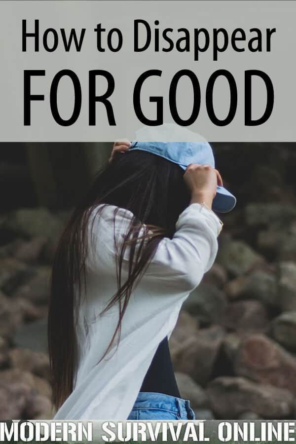
In this article, I’ll tell you exactly what you need to do to completely disappear without a trace.

What are your motives for disappearing?

  • A fresh start. Sometimes your life just needs a reset. Maybe you are single and have been stuck in a rut and are stagnate, personally and professionally. Disappearing is the ultimate way to break routine and experience personal growth.
  • You want freedom and to get off the grid, or at least fly under the radar. Modern life, with a lack of privacy and bombardment with information through electronic devices can be overwhelming.
  • You have abusive family or are in a domestic violence situation. GTFO (Get the Fuck Out) and GYOW (Go Your Own Way).
  • You are trying to break the grip of addiction. You need to change associations. You can never have any contact with anyone you bought from sold to, used with, or handled money for if you want to be clean and sober.
  • The wrong people are looking for you. This can go along with a history of addiction. You need to disappear for your own safety.
  • Everything has gone to shit, there are people looking for you, and the police are way too busy with other matters to protect you.

Bad reasons for disappearing:

  • You are deep in debt and creditors are hounding you. Being a deadbeat is a poor reason for disappearing. Talk to your creditors. People are generally reasonable when you pay them something rather than nothing. You need to be able to look at yourself in the mirror.
  • You are a fugitive from justice. Bad move. Do you want to spend the rest of your life looking over your shoulder? Own up to whatever you did and take your consequences. Break any cycle of criminal behavior.

I am not advocating or suggesting any type of criminal behavior.

Can you actually disappear?

That may not be possible in today’s interconnected, transparent, privacy –gouged nosy-people world. The sacrifices you might have to make in terms of quality of life would be considerable.

The homeless can live off the grid, with no address, utilities, vehicle registration, insurance, or license, no social security card, or other identification. However, they carry all their belongings in a backpack, and may live in a tent off a bike path, or behind a supermarket.

They are exposed to extremes of heat and cold, wind, rain, and snow; they are at risk from hostile homeless people, and drunken belligerent teens that delight in tormenting them. This is extreme. You have to weigh the tradeoffs.

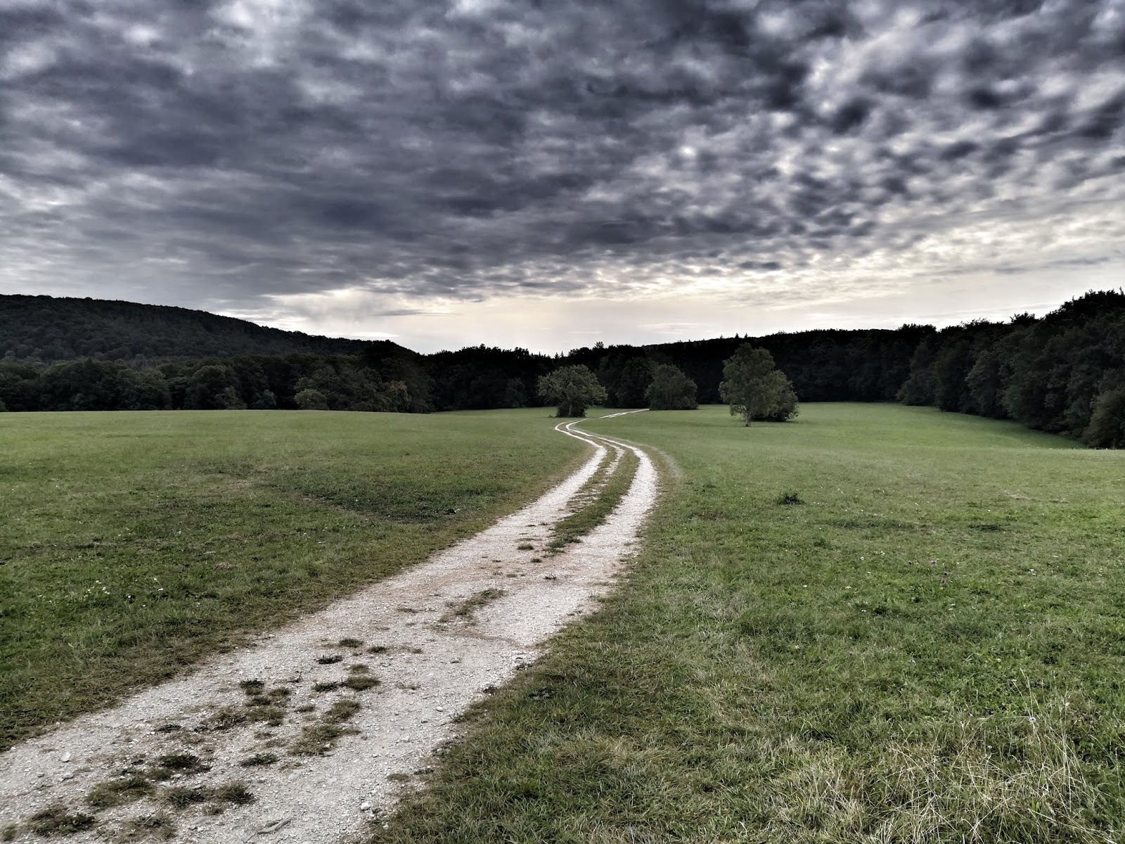
I think a balance can be struck where quality of life would not have to be sacrificed. You can make it very difficult for anyone who is looking to find you. It depends almost exclusively on their level of motivation, resources, and perseverance as to how successful they are.

My philosophy on the topic is the same as any form of self-defense, because disappearing can be a form of self-defense. You cannot defend against and prevail against all opponents, in all situations, and at all times. This is not realistic.

You are not invincible. Even Superman went down for the count after getting nuked. However, as Tim Kennedy says, become hard to kill. Train and prep with the intention that if anyone ever tries to kill you, it will be the most difficult thing they have ever done.

Along a similar line of thought, you can make finding you such an arduous, time consuming, expensive, and frustrating experience that the effort becomes more than it is worth. Be determined that anyone looking for you will be repeatedly confounded, endlessly frustrated, and come up against numerous dead-ends and false leads.

How to Disappear

Prepare

You must be totally committed to this in terms of action and mindset. Half-hearted efforts will result in failure, e.g., you will be found. Preparation is critical.

Step 1) Accept their will be gains and losses- aka change, and a lot of work and preparation.

Step 2) Select a place to go. Make it a major urban area.

Step 3) Do a gradual fade-away, not an actual here one day -gone the next disappearance. The former indicates intent and volition to family and friends, the latter suggests foul play and you will have law enforcement looking for you. You don’t want to be found, nor do you want police wasting time and resources on anyone but actual missing persons.

Step 4) Gradually withdraw money from your IRA, CDs, Money Market, savings and checking accounts, and close them out. Incorporate yourself, so you can open an account under a corporate name at a different bank, hiding your identity.

Save money. Keep what you determine is a reasonable amount of cash on hand. Buy pre-paid debit cards. There are so many available for specific stores and businesses, many of which have branches nationwide.

There are also generic Mastercard and Visa pre-paid debit cards available that can be used anywhere. Pay cash for all purchases, use money orders and pre-paid debit cards only when cash is not an option. Invest in tangible assets such as gold, silver, platinum, and palladium.

Plant caches along your travel/ escape route. Keep cash, copies of documents, USB drives, keys, and other critical items for re-starting your life hidden away.

This is for another layer of personal security as you look for a new job, get a new car, or just-in case situations. Knowing you have some supplies tucked away can reduce anxiety.

Step 5) You will have to sell your home if you own one.

Step 6) You will have to break up with the gf/bf/lover. Do it well in advance. Be nice, not an asshole about it. Send the message this is truly about you, not them, though this has become a break-up cliché to let the other person down easy. Let them let you go instead of frantically searching for someone who has disappeared.

Step 7) Do not tell ANYBODY your intentions.

Step 8) Gradually disconnect from familiar places and people and fade away on social media. Make fewer postings. Do not respond to new friend requests or contacts. Close your social media accounts one at a time, over several months.

Step 9) Opt out of people finders.

Step 10) Shred, burn or otherwise destroy any photos of yourself.

Step 11) Quit your job with sufficient notice. When people ask where you are headed, aim them in the wrong direction. Smile and shake hands with everyone when you leave and thank your supervisor for everything.

Don’t make a big deal out of it. You are just changing jobs, which is the truth. Don’t act sketchy or dramatic like you are going on some sort of secret mission.

Step 12) Be certain your landlord is paid off. Shake hands and thank them for being a good landlord. This is not a big deal, people change apartments all the time; that is all you are doing. Collect your security deposit before you leave. If you own a home, you will have sold it by now.

Step 13) Just before you depart, or on the way, change your appearance. Men, shave your head or grow a ponytail. Shave your face or grow a beard. Lose the beard and keep the ‘stache.

Gain or lose weight. (Yes, I know the latter is easier said than done). Get new clothes which are different from what you normally would wear. Get colored contacts, or wear glasses. Ladies, get a new hairstyle, and/or change your hair color.

Do It

Pick a day and time and go.

On the way to your new life, sell your car for cash. Get a new, generic looking car. Pay cash. Get rid of your clothes and buy new clothes.

Once you get there: Assume people will be looking for you. Practice some tradecraft to stay gone.

1. Use an alias. Your alias can be a permutation of your name. If your full name is John Edward Smith, J.E. Smith can be your knew signature. Or go by Jon, Johnny, or Jonathan. If you don’t normally use your middle initial, start, or drop your middle initial if you do.

2. Get a PO box. Do not get anything but junk mail delivered to your home address.

3. Get a job which preferably pays cash. Day labor, bartending or dishwashing at a family owned bar or restaurant, or construction gigs or on-line freelance work are options. To stay on the right side of the Law, you will have to pay taxes on your earnings. You can pay taxes through your corporate self -and make any under the table job legit. Once again, I do not recommend any illegal activity. If you look like or act like a criminal, you will have people looking for you harder.

4. Start re-building your CV, using a permutation of your name, a PO box, and your new job. Start working toward new certifications or licensure.

5. Be aware of your facial expressions. Our facial expressions are consistent through our lifespan and can lead to someone recognizing you. Practice new facial expressions in front of a mirror until they are automatic.

6. Develop new hobbies and interests, and new habits.

7. Make new friends. Isolated loners get noticed. Anonymous people arouse curiosity.

8. Know what to say when people ask the natural, expected questions about your past. Be certain your past is boring and vague. Strive to bore people.

9. Paint your new car (A different color obviously).

10. Work to become unpredictable. Take different routes to and from home and work and leave and depart at different times.

11. Use cash for purchases as much as possible. Use your pre=paid debit cards when you can. If you use a debit card or use an ATM under your corporate account, do it remote as possible from your place of residence or work, and don’t shop or use the same ATM consistently.

12. Don’t stay put for too long. After a year or so, move again.

13. You cannot EVER go back for ANY reason. Your mother is dying? You can’t go back and say goodbye. Say goodbye to her in your heart. Your Uncle died and left you a million dollars? You can’t claim it.

Once you are gone, stay gone. If you make contact with your past life for any reason, you will be found. Disappearing for good requires total commitment. If you don’t have that level of commitment, then you are not ready.

14. Have fun doing this, especially if the stakes are not high- e.g.,, you are doing a reset. Take this seriously, but don’t make it so grim, or you will walk around looking grim and acting secretive, which will draw attention. Don’t become the neighborhood weirdo. Weirdos are noticed. Once again, strive to bore people and blend in.

Conclusion

Disappearing is a project you have to prepare for and be totally committed to. It is a way to take power back, make yourself safer, and get a fresh start in your life.

But it will also mean sacrifices, and a good degree of discomfort. You must balance the need to disappear with quality of life. This will be an adventure and a challenge.

how to disappear pinterest

How to Disappear for Good Read More »

XMT 304 Issues

Finally got my connex wired for 240V via a subpanel off of my main house circuit. GFCI 50AMP breaker.

I’ve used an XMT for years, just not this particular machine. Picked this one up off of eBay, from a reputable seller. Works great in pulsed MIG (with an Optima). Set my machine up for Lift Arc TIG last night, worked great – but had a sporadic issue.

Was initiating an arc, and all of a sudden the machine starting chattering (contactor) – bead was horrible, and it was almost "split" lengthwise in appearance. Stopped welding immediately, and cycled the machine on and off. Didn’t occur again for the remainder of the evening. Also, I’ve noticed that the machine will "tick" softly while it’s sitting idle. I’ve never heard this noise with the other XMTs that I’ve used, though they were also being used in a noisier environment.

I checked that the lugs on the main board were within torque spec as soon as the machine arrived, however – I’m going to recheck things today. Also, I will inspect the power contactor, to ensure that the springs aren’t gummed up with junk.

Any other suggestions?

Thanks,

Jake

XMT 304 Issues Read More »

The Rae Glacier – Elbow Lake Hike, Kananaskis Country

One of the easiest hikes to do in Kananaskis Country is the hike to Elbow Lake. It’s only 1.3 kilometres in from the trailhead with about 137 metres of elevation gain. If you’re a keen hiker that won’t be enough but there is the option to continue to Rae Glacier. Note that the hike to Elbow Lake is ideal for families. And it makes a great first camping trip.

Beautiful Elbow Lake in Kananaskis Country

Beautiful Elbow Lake in Kananaskis Country

Getting to Elbow Lake from the trailhead

It’s a popular hike to Elbow Lake – in part because it’s short. However it is a steep hike from the get-go, climbing 137 metres to the lake. The trail is on an old fire road through the forest. It’s very obvious and not that interesting until you reach the lake.

Be sure to do a full circuit of Elbow Lake on foot as it’s very pretty from different angles. If you hike it in a counter-clockwise direction you’ll reach the junction with the Rae Glacier trail. Continue instead on a well-worn path to a river crossing of the Elbow on wooden planks. Make your way along the western shore of the lake on a fire road, stopping to admire the blues of the lake and the pretty mountain backdrop.

Keep an eye out for mountain bikers as the trail connects to a network of excellent biking trails in eastern Kananaskis Country so it’s a favourite. Horseback riding is also allowed.

Be sure to do the full hike around Elbow Lake

Be sure to do the full hike around Elbow Lake

The hike to Elbow Lake

Elbow Lake scenery from the fire road on the western shore

Camping at the lake

Elbow Lake is a very popular campground, especially for young families. As you can see in the photo below, most of the campsites are in the trees. But if your timing is right you might be lucky and score campsite 12 or 13 which will give you a view of the lake from your sleeping bag.

There are bear-proof lockers and outhouses as well as several picnic tables some distance from the tents for cooking. Firewood is provided.

For information on booking campsites and important dates visit the Alberta Parks website. Be prepared to book as soon as the dates open up especially if you’re trying to score a summer weekend.

Great family camping at Elbow Lake

Great family camping at Elbow Lake

Beautiful campsite close to the lake

Try and score this campsite close to the lake

Bear boxes at Elbow Lake Campground

Bear boxes at Elbow Lake Campground

The hike from Elbow Lake to Rae Glacier

Continue anti-clockwise around the east shore of Elbow Lake to reach the turnoff to Rae Glacier. There isn’t any signage but there is a piece of flagging tape. The intersection is about halfway along the length of the lake.

Turn right onto a rocky trail heading northeast. Follow the path up a rib. At the top there are some pretty views of three mountains – Rae, Tombstone and Alpaca. 

Continue along the rib eventually descending towards the creek. Stay to the right side of it on the scree. In short order the creek heads left. The névé above the small waterfall – five photos down, is the source of the Elbow River. While you can explore the area around the waterfall the trails here won’t get you to Rae Glacier.

Instead stay right and climb on moraines to the Rae Glacier. Go as far as you feel comfortable. From Elbow Lake to Rae Glacier gain 229 metres over a distance of just 2.2 kilometres. 

Descend the way you came but consider continuing anticlockwise around Elbow Lake to get back to the trail coming up from the parking lot.

Elbow Lake hike and onto Rae Glacier

Look for the flagging tape and turn right

An obvious trail through the rocks on the way to Rae Glacier

An obvious trail through the rocks on the way to Rae Glacier

Hiking up the rib on the way to Rae Glacier

Hiking up the rib on the way to Rae Glacier

Blast of yellow groundcover on a fall hike to Elbow Lake & Rae Glacier

Nice blast of yellow underfoot

The source of the Elbow River

This is NOT the way to the Rae Glacier but it is an area you could explore

There's not much left of the Rae Glacier

Hiking through the moraines on the way to Rae Glacier

Standing on chunks of Rae Glacier

Standing on chunks of what’s left of the Rae Glacier

It's a pretty descent back to Elbow Lake

It’s a pretty descent back to Elbow Lake

Taking in the view on the hike back to Elbow Lake

Taking in the view on the hike back to Elbow Lake

Finding the Elbow Lake trailhead

From Calgary take the Trans-Canada Highway west to the Highway 40 turnoff. Turn south on Highway 40 and follow it for about 62 kilometres. The well-signed trailhead is on the east side of the highway. Note that Highway 40 is closed from December 1 – June 15th every year beginning just past the junction with the Smith-Dorrien Road. There is a winter gate.

Map showing Elbow Lake & Rae Glacier

Map showing Elbow Lake & Rae Glacier in Kananaskis Country

Further reading about nearby hikes in Kananaskis Country

Click on the photo to bookmark to your Pinterest boards.

The hike to Elbow Lake & Rae Glacier in Kananaskis Country

The post The Rae Glacier – Elbow Lake Hike, Kananaskis Country appeared first on Hike Bike Travel.

The Rae Glacier – Elbow Lake Hike, Kananaskis Country Read More »